
Blog
Multi-constellation RTK: The Future of High-Precision Positioning
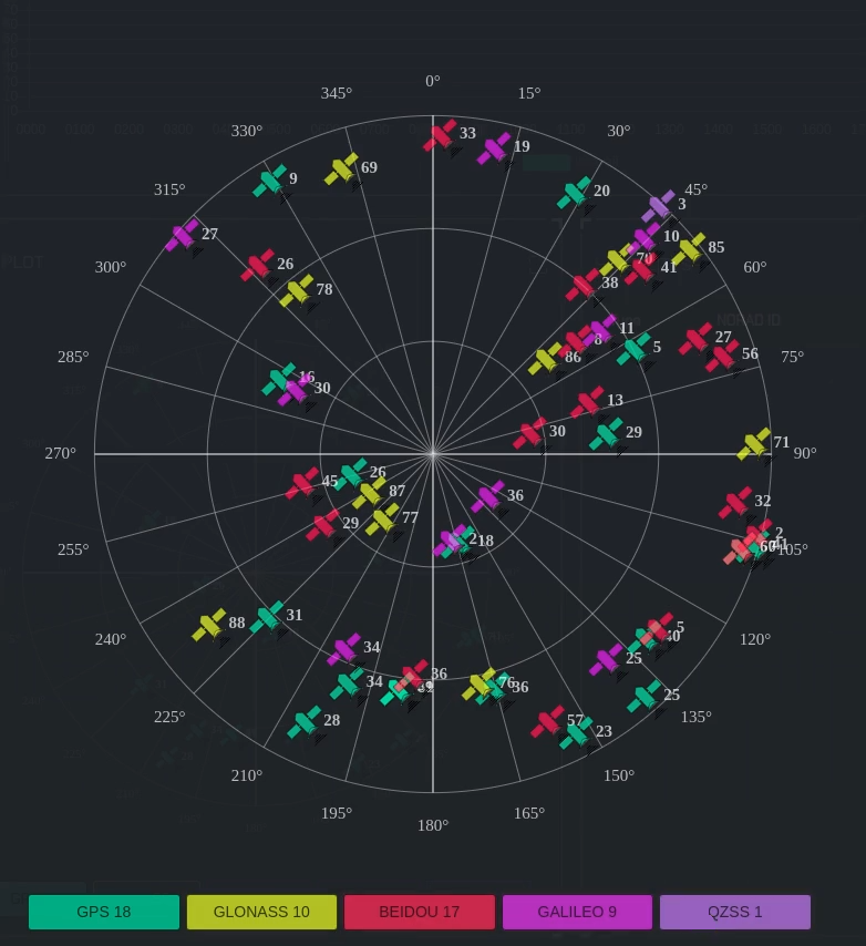
Real-Time Kinematic (RTK) technology has revolutionised the way farmers and growers operate, providing them with sub-centimeter accuracy that enables precise control of equipment, reduces waste, and ultimately increases yields. One of the key developments in recent years has been the emergence of multi-constellation RTK systems, which use multiple satellite constellations to improve accuracy and reliability. Traditionally, RTK systems relied solely on the Global Positioning System (GPS) to provide positioning data. While GPS is still the primary satellite constellation used in RTK systems, it has its limitations. GPS signals can be affected by a range of factors, including atmospheric conditions, terrain, and the position of the satellites in the sky. This can result in inaccuracies in…
Autonomous Vehicles & RTK Technology For Prevision Agriculture
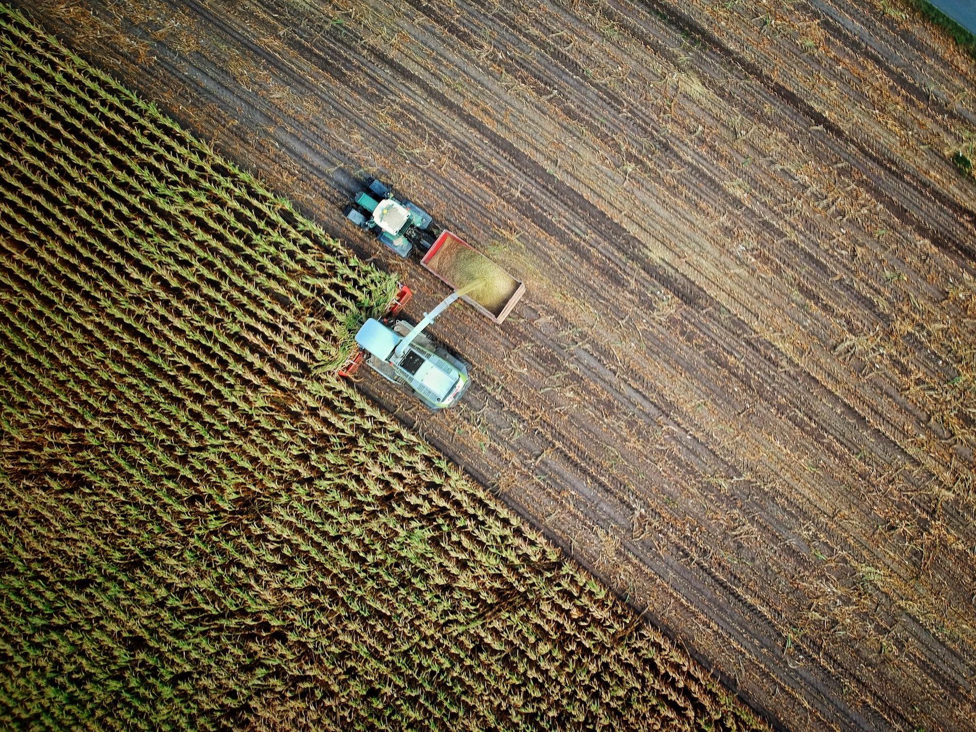
Precision agriculture has been transforming the way farmers and growers operate, allowing for more efficient use of resources and ultimately increasing yields. One of the key developments in recent years has been the emergence of autonomous vehicles for precision agriculture, which use Real-Time Kinematic (RTK) technology to enable precise control of equipment. This technology is revolutionising the industry by allowing farmers to automate tasks such as planting, harvesting, and spraying, leading to increased efficiency and productivity. Popularity of Autonomous Farming Vehicles Autonomous vehicles are becoming increasingly popular in agriculture, as they can perform tasks that would otherwise require a significant amount of time and labour. By using RTK technology to provide…
Drones & UAV: RTK Technology For Improved Mapping
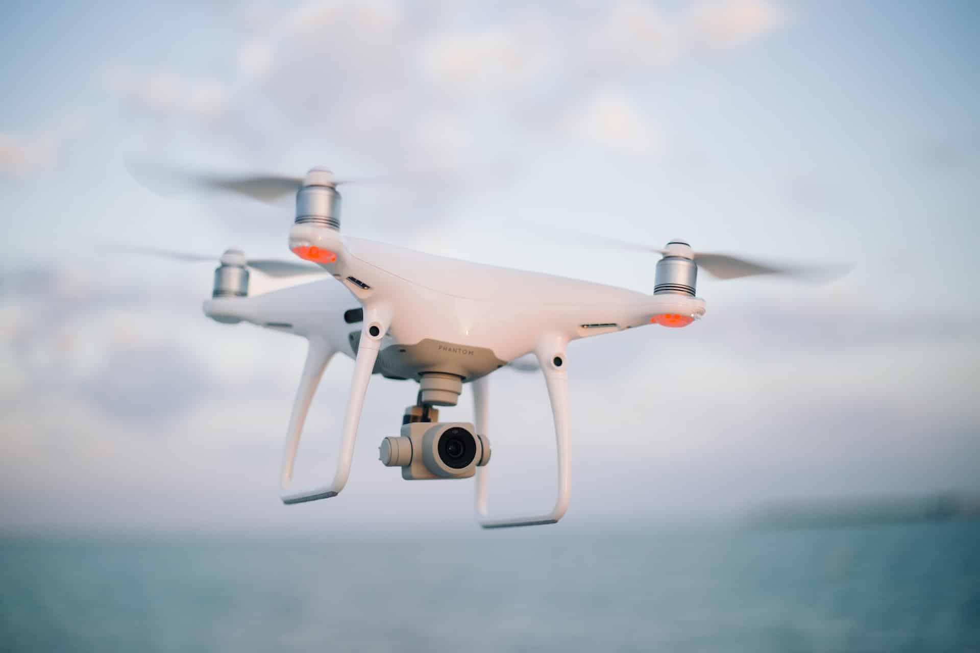
Drones and Unmanned Aerial Vehicles (UAVs) have become increasingly popular in agriculture in recent years, offering farmers and growers a cost-effective and efficient way to survey crops and fields. However, the accuracy of these surveys can be limited by the technology used to navigate and map the area. That’s where Real-Time Kinematic (RTK) technology comes in, allowing for greater precision in mapping and surveying, ultimately leading to better decision-making and increased yields. RTK technology works by using satellite signals to provide sub-centimetre accuracy, which is essential for precise mapping and surveying. By providing highly accurate positioning information, RTK technology enables drones and UAVs to navigate and survey fields with greater precision, collecting more…
Cloud Based RTK: The Future of Precision Agriculture
Real-Time Kinematic (RTK) positioning technology has revolutionised precision agriculture, providing farmers with highly accurate positioning data to optimise their planting, harvesting, and other farm operations. However, traditional RTK systems can be limited by their dependence on physical base stations and local networks. This is where cloud-based RTK solutions come in, offering farmers and growers access to RTK positioning data from any location with an internet connection. Why Choose A Cloud Based RTK System? Cloud-based RTK solutions are becoming more popular in precision agriculture due to their ease of use, flexibility, and cost-effectiveness. By eliminating the need for physical base stations, cloud-based RTK farming solutions allow farmers to access highly accurate…